
![Glacier Peak Wilderness Map [Mt. Baker-Snoqualmie and Okanogan-Wenatchee National Forests] (National Geographic Trails Illustrated Map, 827)](https://zekewanders.com/wp-content/uploads/2025/02/glacier-peak-wi_0.jpg)
![Glacier Peak Wilderness Map [Mt. Baker-Snoqualmie and Okanogan-Wenatchee National Forests] (National Geographic Trails Illustrated Map, 827) - Image 2](https://zekewanders.com/wp-content/uploads/2025/02/glacier-peak-wi_1.jpg)
![Glacier Peak Wilderness Map [Mt. Baker-Snoqualmie and Okanogan-Wenatchee National Forests] (National Geographic Trails Illustrated Map, 827) - Image 3](https://zekewanders.com/wp-content/uploads/2025/02/glacier-peak-wi_2.jpg)
![Glacier Peak Wilderness Map [Mt. Baker-Snoqualmie and Okanogan-Wenatchee National Forests] (National Geographic Trails Illustrated Map, 827) - Image 4](https://zekewanders.com/wp-content/uploads/2025/02/glacier-peak-wi_3.jpg)
![Glacier Peak Wilderness Map [Mt. Baker-Snoqualmie and Okanogan-Wenatchee National Forests] (National Geographic Trails Illustrated Map, 827) - Image 5](https://zekewanders.com/wp-content/uploads/2025/02/glacier-peak-wi_4.jpg)
![Glacier Peak Wilderness Map [Mt. Baker-Snoqualmie and Okanogan-Wenatchee National Forests] (National Geographic Trails Illustrated Map, 827) - Image 6](https://zekewanders.com/wp-content/uploads/2025/02/glacier-peak-wi_5.jpg)
![Glacier Peak Wilderness Map [Mt. Baker-Snoqualmie and Okanogan-Wenatchee National Forests] (National Geographic Trails Illustrated Map, 827) - Image 7](https://zekewanders.com/wp-content/uploads/2025/02/glacier-peak-wi_6.jpg)


Sale
Trending
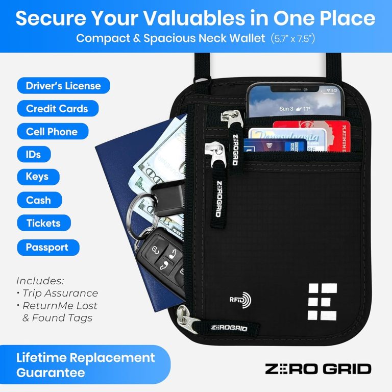
Neck Wallet for Travel & Passport Holder with RFID Blocking - Slim & Easy to Conceal Nylon Travel Pouch for men & women - Holds Phone, Cash, Cards, Keys - Sweat & Water Resistant - Large - Black
Original price was: €29.99.€19.90Current price is: €19.90.
Sale
Trending
Neck Wallet for Travel & Passport Holder with RFID Blocking - Slim & Easy to Conceal Nylon Travel Pouch for men & women - Holds Phone, Cash, Cards, Keys - Sweat & Water Resistant - Large - Black
Original price was: €29.99.€19.90Current price is: €19.90.


Sale
Trending
Luggage Tags Business Card Holder by TUFFTAAG - Durable Travel ID Bag Tag in Multiple Color Options, Perfect for Suitcases, Backpacks, and Carry-Ons, Easy Identification, Secure and Stylish
Original price was: €19.99.€15.99Current price is: €15.99.


Sale
Trending
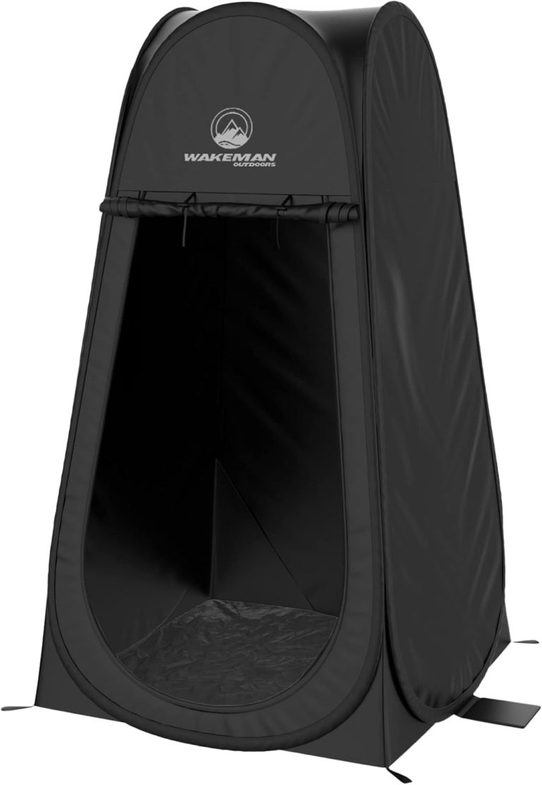
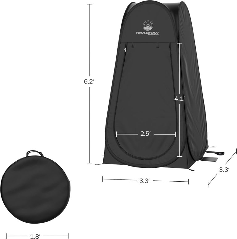
Pop Up Pod - Privacy Shower Tent, Dressing Room, or Portable Toilet Stall with Carry Bag for Camping
Original price was: €39.99.€28.62Current price is: €28.62.
![Glacier Peak Wilderness Map [Mt. Baker-Snoqualmie and Okanogan-Wenatchee National Forests] (National Geographic Trails Illustrated Map, 827)](https://zekewanders.com/wp-content/uploads/2025/02/glacier-peak-wi_1-768x768.jpg)
